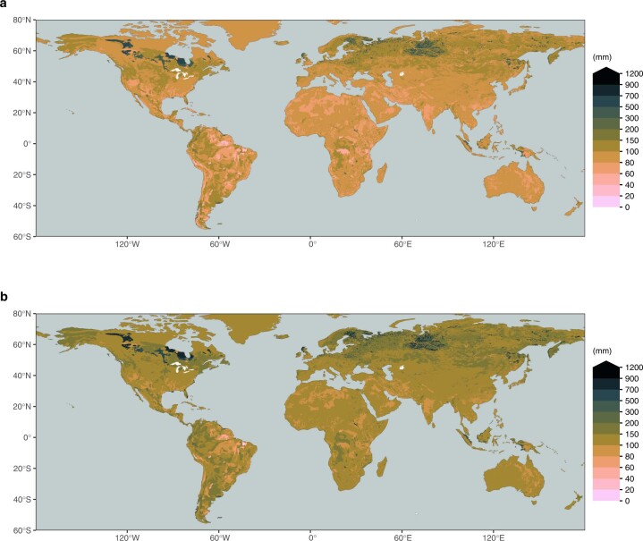
Extended Data Fig. 5. Integrated soil water holding capacity in the soil.
Integrated soil water holding capacity across the top 1 m (a) and the top 2 m (b). Values are calculated based on soil texture information from a gridded version30 of the Harmonized World Soil Database29 and pedo-transfer functions based on ref. 31. HWSD provides information for a top layer (0-30 cm depth) and a bottom layer (30-100 cm depth). For the top 2 m shown in (b), we assumed values from the bottom layer for 100-200 cm depth.

