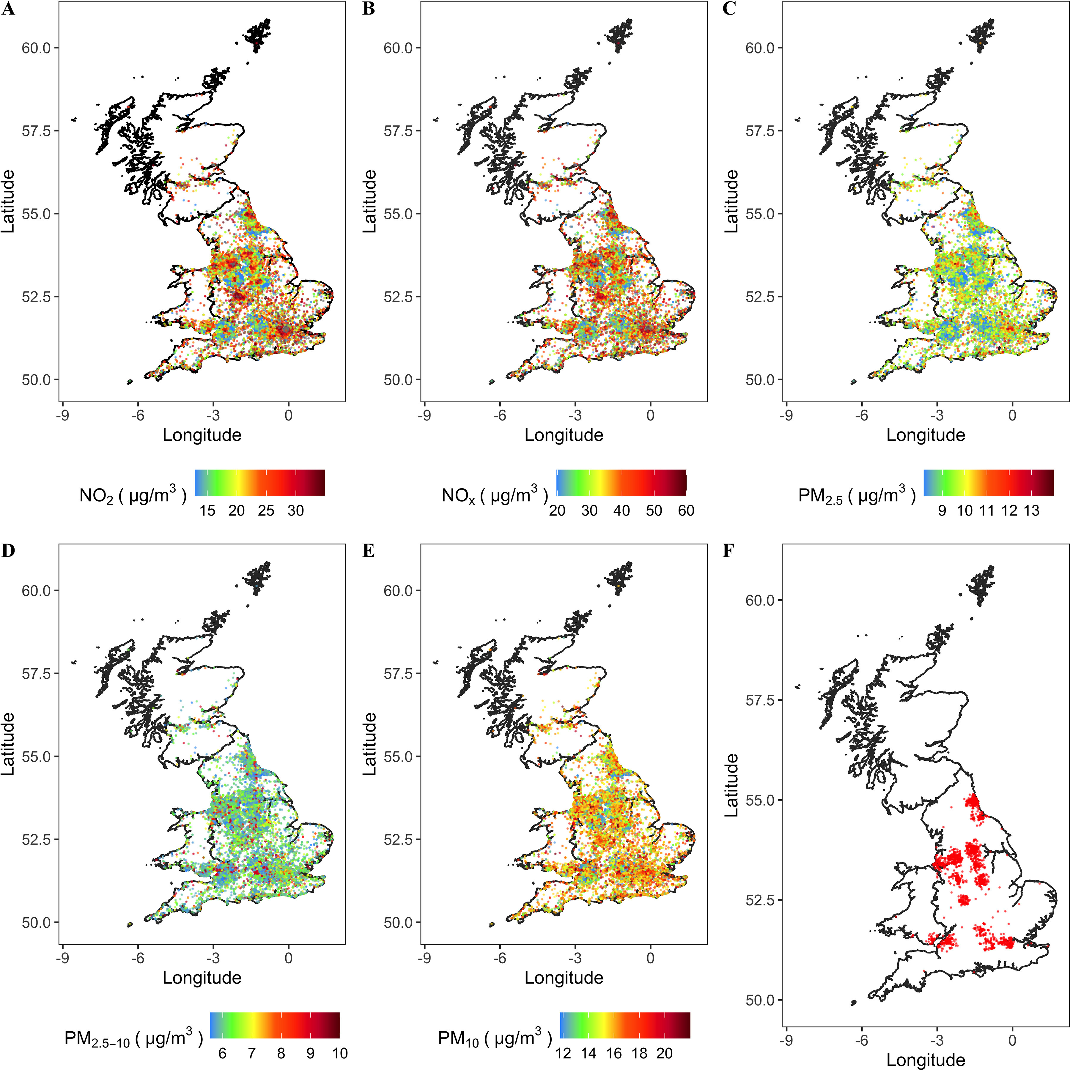
Figure 1.

Map of air pollution (, , , , and ) of areas where participants lived in 2010 and map of incident RA scatter distribution. The administrative boundary data of the UK are sourced from UK Government Open Data portal (https://data.gov.uk/dataset/3fd8d2d2-b591-42ff-b333-c53a6a513e96/countries-december-2017-full-clipped-boundaries-in-great-britain). These data are UK government–released open data. (A) , (B) , (C) , (D) , (E) , and (F) incident RA. Note: , nitrogen dioxide; , nitrogen oxides; , particulate matter with aerodynamic diameter ; , particulate matter with aerodynamic diameter ; , particulate matter with aerodynamic diameter ; RA, rheumatoid arthritis.
