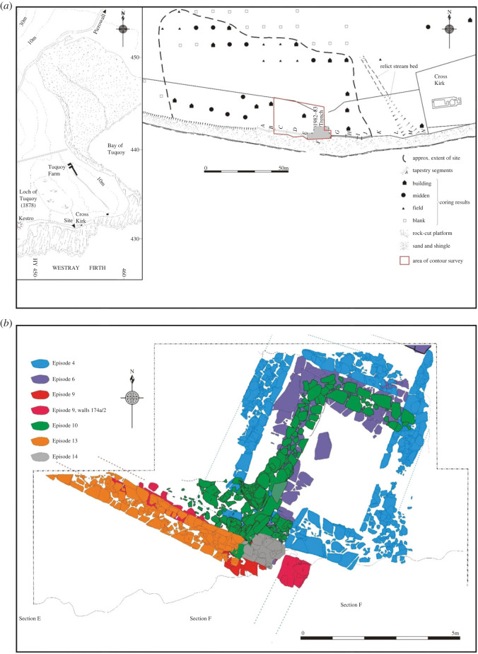
Figure 1.
Tuquoy. (a) Map showing the location and surviving extent of the site and (b) plan of the major structures investigated in the 1982–1983 excavation area. In (b), two phases are represented: Phase 3 (Episodes 4 and 6: construction and refurbishment of the hall) and Phase 4 (Episodes 9, 10, 13 and 14: construction and rebuilds of the workshop). © Historic Environment Scotland.

