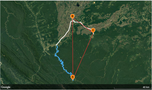
Fig. 1.

Map and spatial ability tasks. GPS map shows travel paths between points of interest using the serpentine Maniqui River (in blue) and road travel (in white). While the straight lines (in red) represents travel paths as the crow flies from (A) to (B), with a total distance of 25.87 km, the river and road travel route from (A) to (B) has a total distance of 124 km. To measure pointing error, participants were asked to point from their location (A) to a target location (B). The perspective‐taking task required participants to point as though they were at a distant location (B) to separate targets (e.g., A and C).
