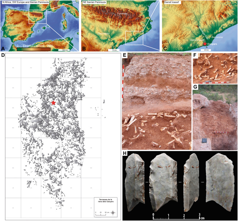
Fig. 1. Site location and stratigraphy.
(A to C) Location of Canyars in southwestern Europe (A), NE of Iberian Peninsula (B), and the Garraf massif (C). (D) Distribution of the large mammal remains in Cala A-Rasa D plotted against the excavation grid and bone provenance (red star). (E) Layer I and its stratigraphy. (F) Detail of bone accumulation from M to N 23 to 25 grid squares. (G) The paleochannel before archaeological excavation. (H) Blade with Aurignacian retouch from Canyars. (A to C) Map extracted from OpenStreetMap (CC BY-SA). OpenStreetMap licensed under ODdL 1.0 (https://openstreetmap.org/copyright) by the OpenStreetMap Foundation (OSMF). OpenStreetMap contributors (https://openstreetmap.org/). Scale bar (E to G), 1 m.

