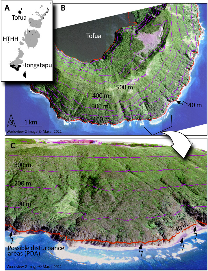
Fig. 5. Post-tsunami disturbances along the southern flank of Tofua Island based on synthetic aperture radar, DEM, and optical imaging analysis.
(A) Location of Tofua 90 km north of the Hunga submarine caldera (HTHH). (B) Nadir view of the southern flanks of Tofua from Canadian Space Agency’s (CSA) Radarsat Constellation Mission (RCM) C-band HH polarization spotlight SAR (1-m resolution, inverted in its backscatter) at 46° incidence with semitransparent Maxar WorldView (WV-02) visible wavelength data (resampled to 1 m) and superimposed DEM contours every 100 m from sea level (in purple), as well as the 40 m (above-sea-level) contour in orange. (C) Oblique view ray-traced using the co-registered synthetic aperture radar (SAR), with the 1-m ground sample distance (GSD) DEM, with the ocean view from WV-02 acquired 2 September 2022, and the inverted RCM-SAR acquired by the CSA in Spotlight (beam FSL30) mode on Aug. 24th, 2022. Pink to magenta correspond to possible disturbance areas (PDAs) identified in the satellite data. These putative tsunami-related disturbances require field validation for confirmation but are suggestive of runups up to 45 m in this steeply sloping region. GEDI and ICESat-2 LIDAR topography has been used to evaluate the steepest slopes in this central, southern portion of the Tofua volcanic island. RCM-SAR data courtesy of RCM image at 2022 courtesy of the government of Canada.

