
Figure 1.
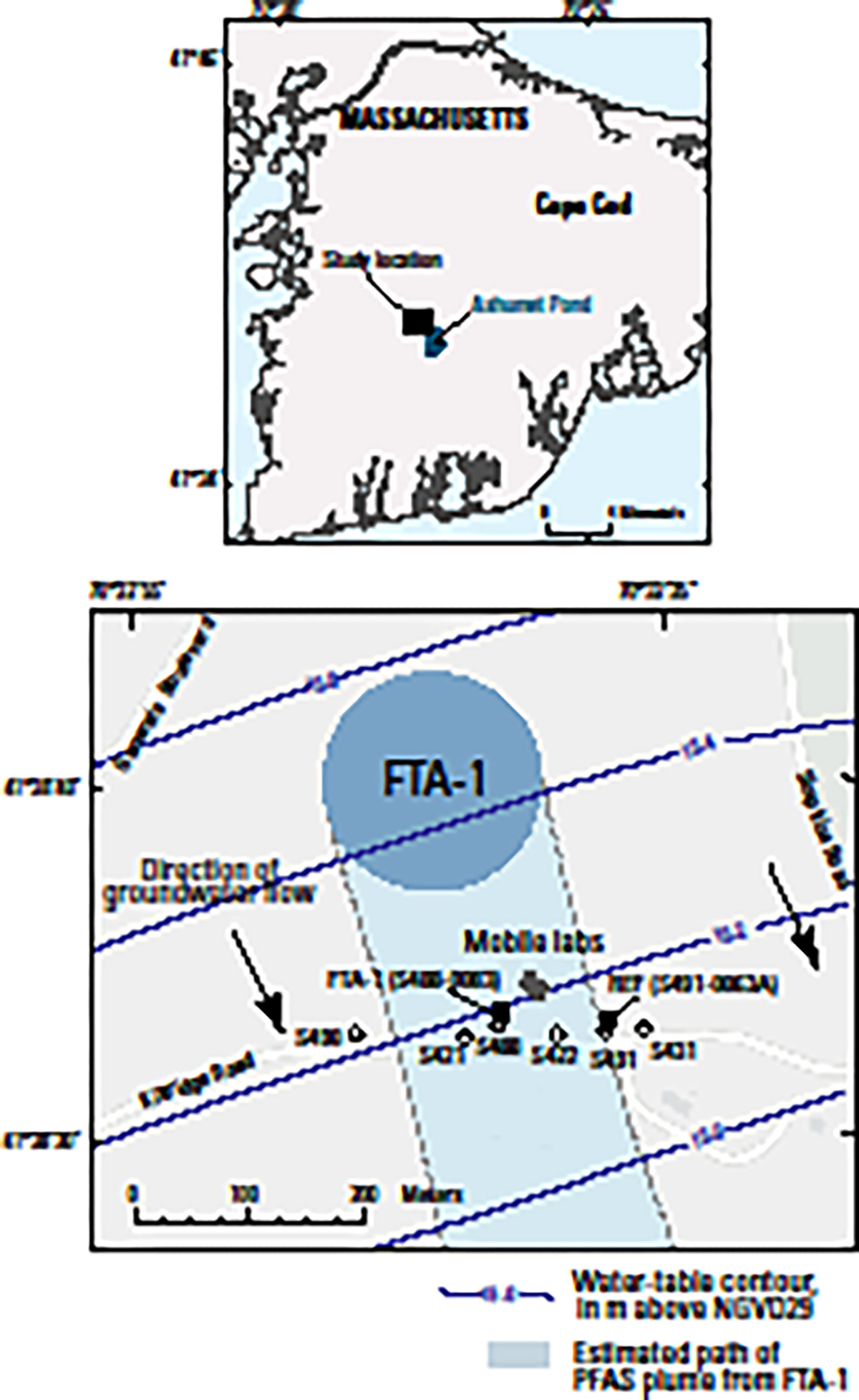
Site map showing locations of (1) the per- and polyfluoroalkyl substance (PFAS) groundwater contamination plume originating from a historical fire-training area (FTA) on Cape Cod, Massachusetts, (2) monitoring wells used to define the plume boundary, (3) water-table contours and inferred groundwater-flow direction, and (4) reference (REF; MA-SDW 491–0063A) and FTA contaminated (FTA-1; MA-SDW 488–0083) groundwater wells used for the mobile laboratory exposure experiments. The REF well was located on the complex “fringe” of the plume and does not represent pristine uncontaminated groundwater but rather provided an order of magnitude concentration gradient from FTA-1. [Water-table contours adapted from reference 63; see Table S1 for well information; dashed lines indicate inferred boundary.]