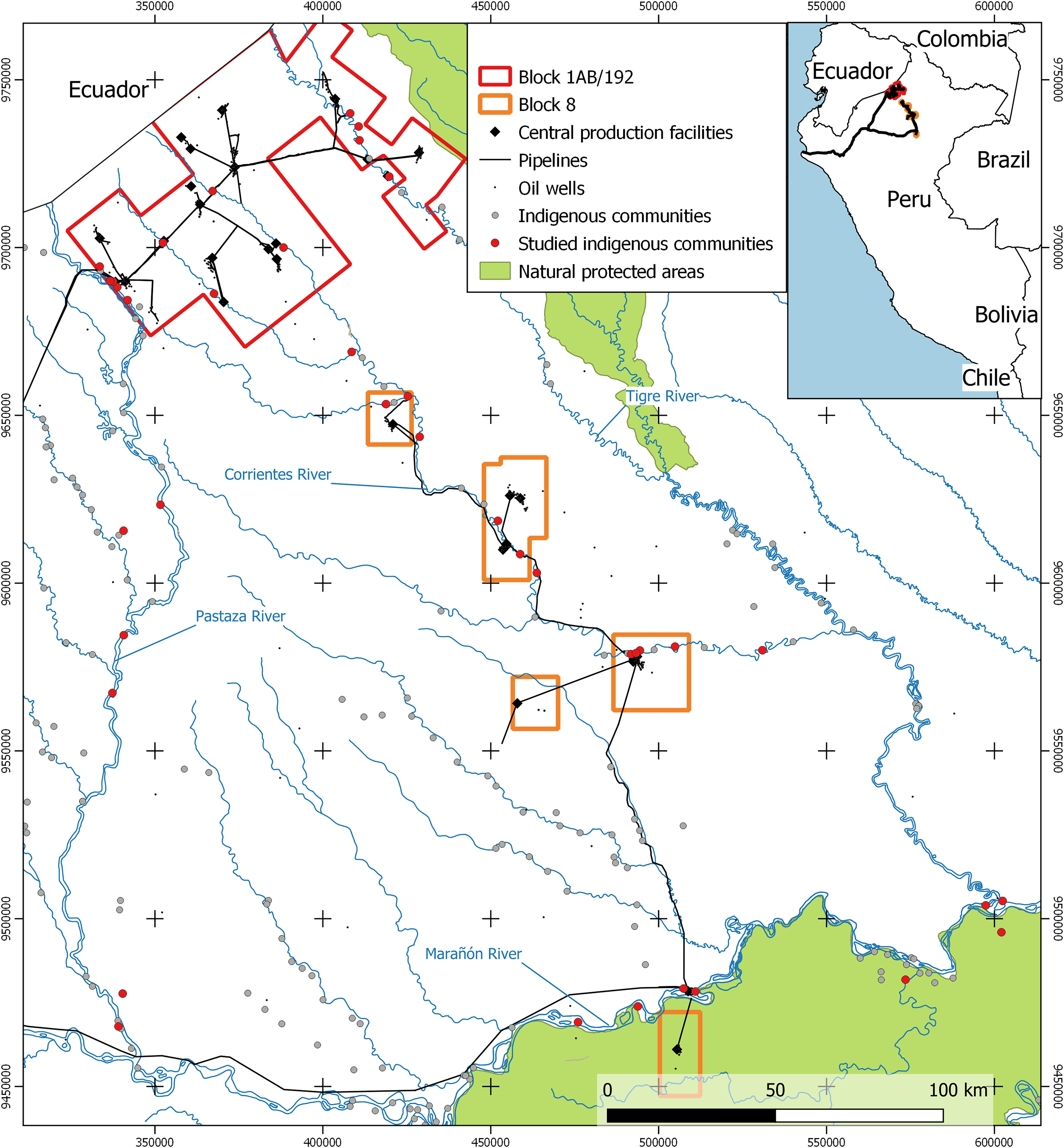
Figure 1.

Map of the study area. Block 1AB/192 and Block 8 refer to the two oil concessions areas that overlap with the territories of the Achuar, Quechua, Kichwa, and Kukama Peoples in the Corrientes, Pastaza, and Tigre river basins of the northern Peruvian Amazon. Central processing facilities include production facilities where oil, gas, and produced water are collected from the oilfield and separated, as well as storage tanks, flare systems, utilities, and support buildings. The figure was elaborated using ArcGIS Pro (version 2.5.0; ESRI) and open-access spatial data on oil concessions and infrastructure, indigenous communities, and natural protected areas.
