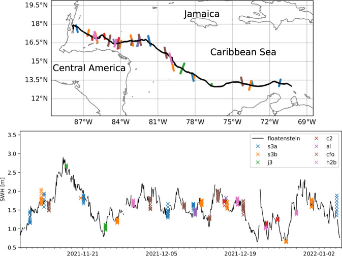
Fig. 8.
Validation of the instrument v2021 against satellite measurements, reproduced from38. Top: drift trajectory of a freely drifting, open water version of the instrument v2021 (black), and illustration of satellite swaths intersecting the trajectory over the drift period (colored point clouds). Bottom: comparison of the significant wave height (SWH) reported from the v2021 (nicknamed “floatenstein”), with satellite measurements from a variety of satellites. SWH comparison between the v2021 and the satellite measurements are in agreement, with the measurements from the v2021 always falling within the spread for each satellite measurement swath. While this is obtained from a deployment performed in the Caribbeans, this is a validation of the correct functioning of the wave measurement routines. The satellites used are: s3a: Sentinel-3A; s3b: Sentinel-3B; c2: CryoSat-2; j3: Jason-3: al: SARAL/ALtiKa; cfo: CFOSAT (on board altimeter not from the SWIM instrument); h2b: Hai Yang 2B.

