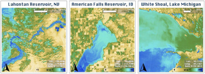
Figure 2.
High spatial resolution (30 m Landsat) and surface temperature sensitivity of AquaSEBS reveals dynamic spatial patterns in evaporation across reservoirs and lakes. These patterns encompass near shore changes related to bathymetry, north–south or east–west gradients across the water bodies, and circulation-based patterns as heat distributes via currents. Here, three examples are shown for Lahontan Reservoir, Nevada (left); American Falls Reservoir, Idaho (middle); and, White Shoal, Lake Michigan (right). Python version 3.9.5 was used to process all data and produce the map figures. QGIS version 3.18 was used to add map elements to the figures.

