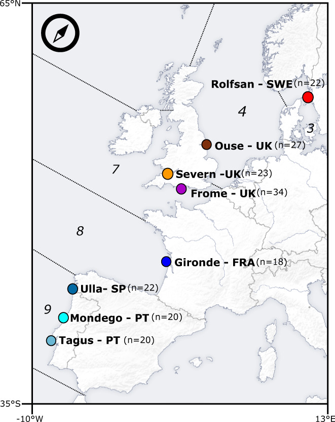
FIGURE 1.

Geographic information and distribution of sampled locations. Here represented are the sampled freshwater locations (dots) and respective correspondence to FAO's major fishing areas in the Northeast Atlantic (italicized numbers), delineated by dashed lines. Specifically, 3 corresponds to Skagerrak, Kattegat, Sound, Belt Sea, and Baltic Sea, 4 to the North Sea, 7 to Irish Sea, West of Ireland, Porcupine Bank, Eastern and Western English Channel, 8 to the Bay of Biscay and 9 to the Portuguese waters. In parenthesis, the number of individuals collected for each location was utilized in this study.
