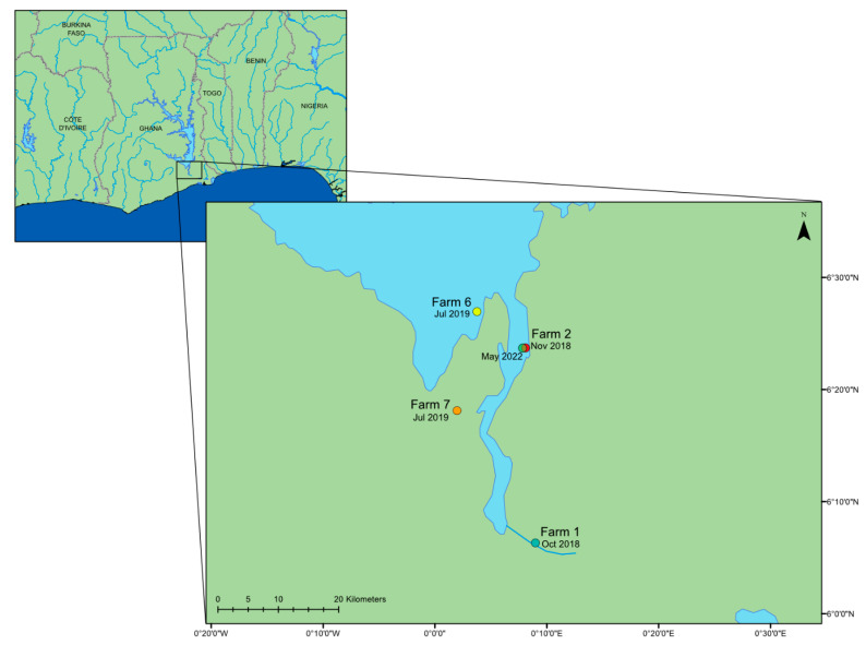
Figure 1.
A map of the lower region of Lake Volta in Ghana, West Africa, showing the date and location of the farms where the outbreaks of mortality occurred; locations retrieved from [11]. This map was constructed using ArcGIS (GIS software). Version 10.0. Redlands, CA, USA: Environmental Systems Research Institute, Inc., 2010.

