
Figure 5.
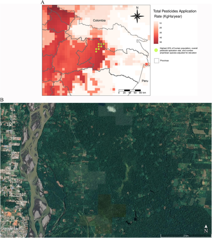
(a) Overall pesticide application rates in Ecuador. Data were extracted from PEST‐CHEMGRIDSv1 (∼8 km resolution at the equator) for the year 2015. Dotted areas indicate where the highest 20% application rates, highest 20% population density, and the highest 20% number of amphibian species adjusted for elevation overlapped; (b) Satellite image illustrating part of one of the eight 8 km × 8 km where the highest 20% application rates, highest 20% population density, and the highest 20% number of amphibian species adjusted for elevation overlapped. Note: CNES/Airbus image extracted from Google Earth v. 7.3.4 for 20 September 2018. Geographic coordinates: 0°24′36.07″S, 76°57′33.37″W. Eye altitude: 8.4 km.