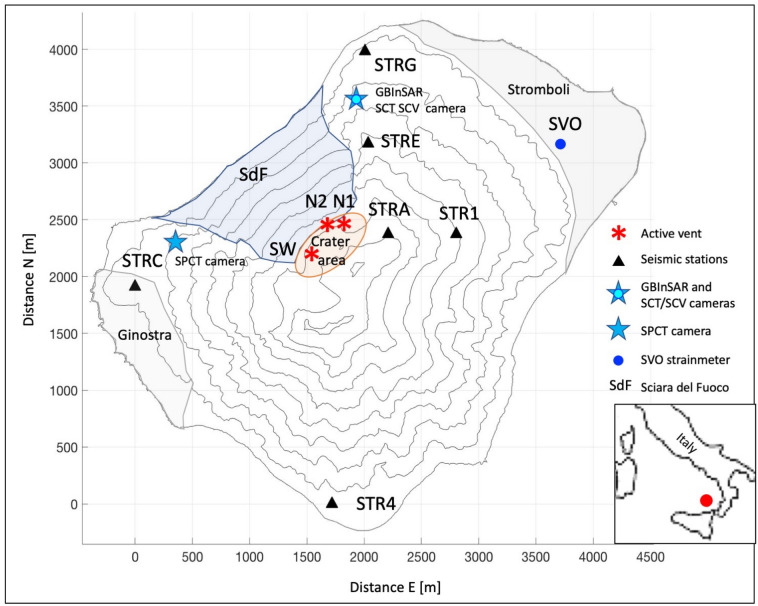
Figure 1.
The Stromboli volcano map with the location of the geophysical instruments used for this work. The black triangles are the seismic stations, the blue star with the cyan circle inside indicates the GBInSAR device and the SCT and SCV cameras, the blue star on top of the volcano indicates the SPCT camera, the blue circle marks the position of the SVO strainmeter. The villages of Stromboli and Ginostra, the slope of the Sciara del Fuoco (SdF) and the crater area are shown on the map. The position of the eruptive vent that generated the studied events (N2 vent) is indicated with the N2 red asterisk. N1 red asterisk marks the location of crater N1 and SW red asterisk represents the southwest crater area (SW). The geographical position of Stromboli in the Mediterranean Sea is indicated in the box at the bottom right of the figure (red circle).

