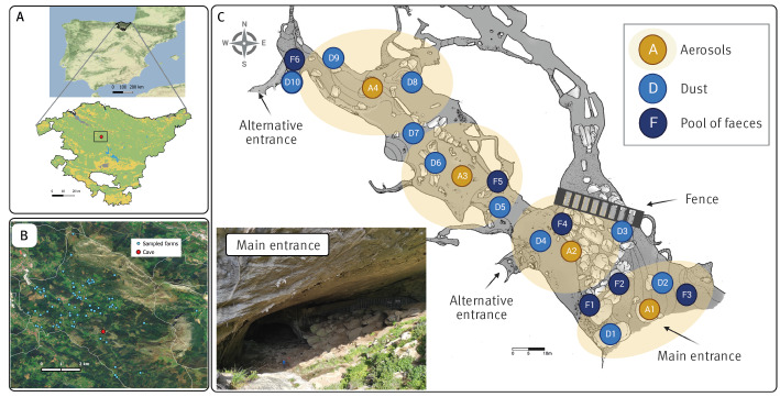
Figure 1.
Illustration of the natural cave linked to the Q fever outbreak, Bizkaia, Basque Country, Spain, December 2020–October 2021
A. Map of Spain with an inset showing the location of the cave (red circle).
B. Location of the goat and sheep farms sampled and tested (blue dots) in relation to the cave (red circle).
C. Topographic map of the cave (developed by Jabier Les, G.E.T. Espeleologi taldea). Sampling sites of faecal (F1–F6), dust (D1–D10) and aerosol (A1–A4) samples are indicated. Yellow circular shadows represent the area covered by the air sampler. The approximate location of the fence that prevents entrance to the area with bats is indicated (using BioRender, https://www.biorender.com).

