
Figure 2.
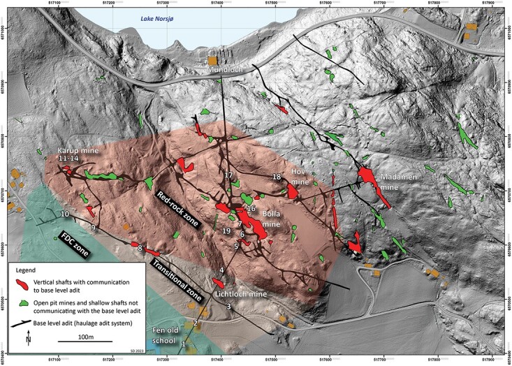
Laser imaging, detection and ranging (LIDAR) map of Fen iron legacy mines (Mining Hill) with open pits in green and mine openings in red and measurement points given by numbers. Numbers 1 and 2 are the SM, 3–6 Lichtloch, 7 and 19 Bolla mine, 8 and 9 the AC mine, 10 the western mine, 11–14 the Karup mine and 16–18 the main adit. Main adit base level runs from Fen Bay to beneath Gruvehaugen (large mine Bolla opening in center of map) and all mines below this level are flooded with water. Bedrock type is shown as red for redrock, green for FDC and the transition zone in between.