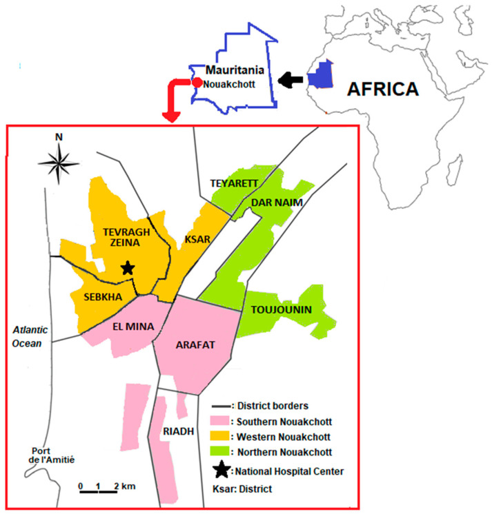
Figure 1.
Map of Nouakchott, Mauritania, showing the location of the study site: the National Hospital Center located in the Tevragh Zeina district. Colored areas correspond to three Nouakchott regions: northern Nouakchott region (light green), including the districts of Dar Naim, Teyarett, and Toujounin; southern Nouakchott region (salmon pink) with the districts of Arafat, Riadh, and El Mina; and western Nouakchott region (orange) corresponding to the districts of Sebkha, Tevragh Zeina, and Ksar. The large white band in a rectangular shape in the Dar Naim district represents the former international airport (closed since 2016 due to the opening of the new international airport situated outside the city). The Atlantic Ocean lies to the west of the city. Adapted from [32]. Figure available online: http://books.openedition.org/pupo/docannexe/image/17487/img-2.jpg (accessed on 15 September 2022).

