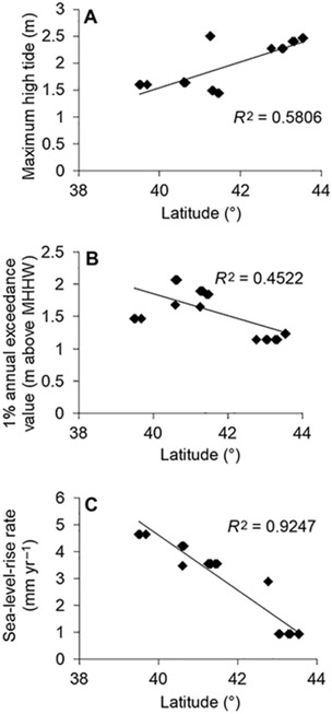
FIGURE 2.
(A) Maximum high-tide height, as measured by maximum observed water level, May–August, 2011–2013, by study plot. Maximum high-tide height generally increases with latitude on the northeastern coast of the United States. (B) Extremity of rare flooding events, as measured by 1% annual exceedance value above the typical high-water mark (mean higher high water [MHHW]), by study plot. Areas within the geographic center of the Saltmarsh Sparrow range experience the highest exceedance values. (C) Relative sea-level-rise rate by study plot. Generally, sea-level-rise rate decreases with latitude within this region.

