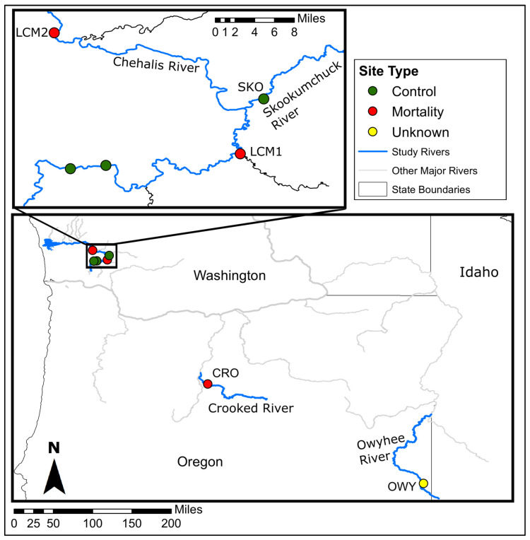
Figure 1.
Map of sampling sites and monitoring locations used in this study. Inset map shows more detail for sites in the Chehalis River watershed. Sample sites are labeled with their corresponding codes as described in the text. The two unlabeled sites on the Chehalis River show sites where we confirmed that mussel mortality was not occurring, but did not sample for this study.

