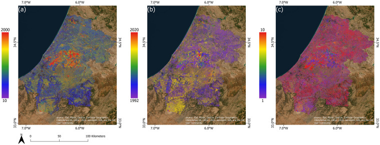
Fig 12. The LandTrendr results using the Tasseled Cap Brightness (TCB) in the RSK region, Morocco.
(a) The magnitude of the change, (b) the year of the change, (c) the duration of the change. Map was created using ArcGIS (version 10.6) from Esri (http://www.arcgis.com). Basemap satellite images accessed from World Imagery Esri Tile Layer. Credits: Esri, Maxar, GeoEye, Earthstar Geographics, CNES/Airbus DS, USDA, USGS, AeroGRID, IGN, and the GIS User Community.

