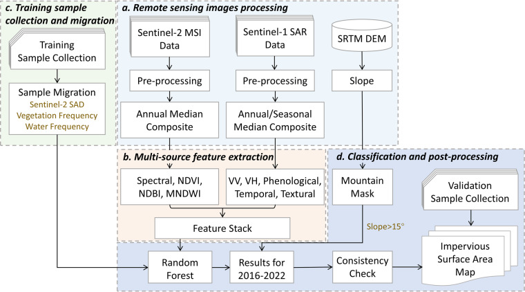
Fig. 2.
Workflow for developing multi-temporal impervious surface area maps. MSI: Multispectral Images; SAR: Synthetic Aperture Radar; SRTM: Shuttle Radar Topography Mission; DEM: Digital Elevation Model; SAD: Spectral Angular Distance; NDVI: Normalized Difference Vegetation Index; NDBI: Normalized Difference Built-up Index; MNDWI: modified Normalized Difference Water Index; VV: vertical-vertical band of Sentinel-1 images; VH: vertical-horizontal band of Sentinel-1 images.

