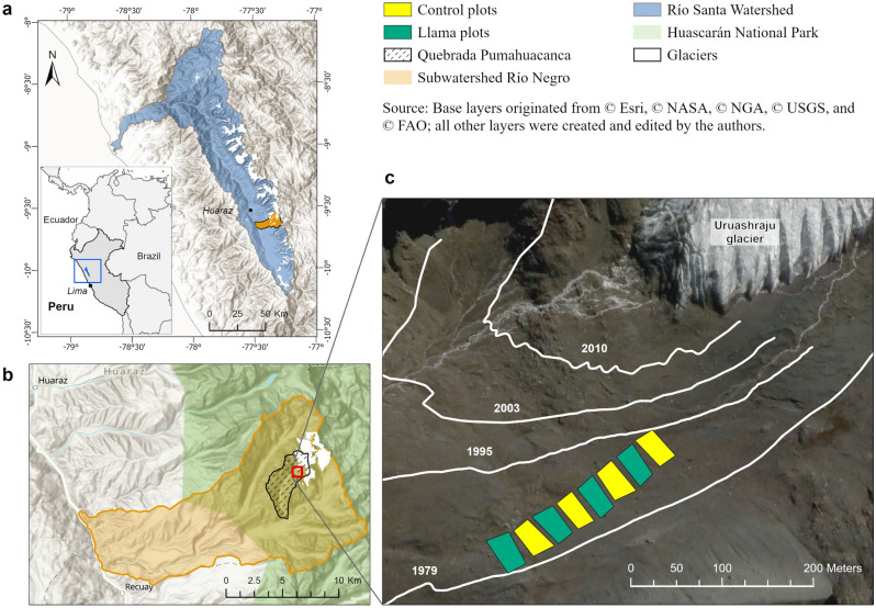
Figure 1.
Location and study site set-up. Map of location with respect to the Santa River watershed (a), and Río Negro sub-watershed (b). Map of the experiment within the Uruashraju glacier foreland (c). The glacier retreat outlines were produced and provided by the ANA (Área de Evaluación de Glaciares y Lagunas, Autoridad Nacional del Agua, Huaraz) based on topographic field surveys of the glacier fronts since 1948, and analysis of photographs. Maps generated by authors with licensed software ArcGIS Pro 3.0.2 (https://www.esri.com/en-us/arcgis/products/arcgis-pro/).

