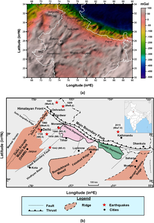
Figure 1.
(a) Bouger gravity map of northern & central India and surroundings (after WGM2012 Model from https://bgi.obs-mip.fr/data-products/grids-and-models/wgm2012-global-model/) with marked prominent gravity highs (H1, H2 and H3). The map is created with the software ArcGIS version 10.7.1. (https://www.esri.com/en-us/arcgis/products/arcgis-desktop/resources). (b) the basement structure of the Ganga Basin based on Fuloria3 and Sastri et al.4, the location of Delhi Sargodha Ridge is plotted after GSI5. The figure is digitized using the software ArcGIS version 10.7.1. (https://www.esri.com/en-us/arcgis/products/arcgis-desktop/resources).

