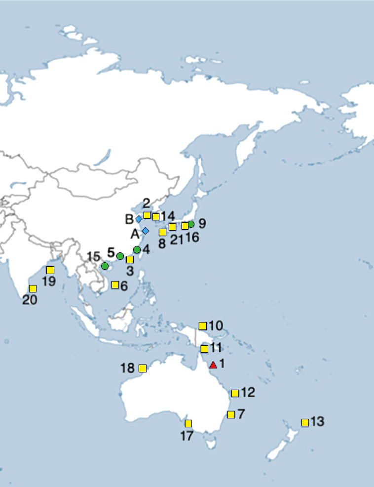
Fig. 4.

Biogeographical map showing validated wild capture distribution records for Eirenemenoni and Eirene lacteoides. Eirene menoni records that are indicated by red triangle refer to holotype location, green circles refer to localities with COI mtDNA sequences, and yellow squares refer to localities obtained from published studies with sufficient description detail or documentation. Eirene lacteoides records are indicated by a blue diamond. The GPS data for these records is located under the specific species in the text. Specimens with public aquaria captive culture locations are referred to in the manuscript text.
