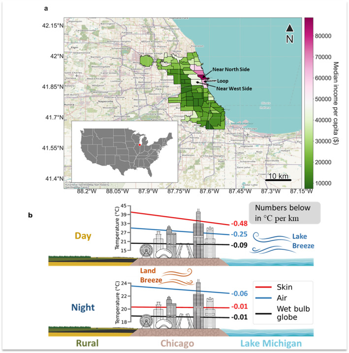
Figure 1.

Study area and overview schematic. (a) Spatial extent of Chicago neighborhoods (inset marks location of Chicago within the United States) and the median income per capita in each. (b) Conceptual schematic of Chicago in reference to Lake Michigan and rural Illinois with daytime and nighttime (corresponding to MODIS Aqua overpasses) lake‐to‐land gradients in skin temperature, air temperature, and wet bulb globe temperature derived from the five‐member ensemble mean of WRF models simulations and the proximity of the neighborhood centroids to the lake shore. The numbers annotated with the colored gradients show the slopes of the best fit lines in °C per km distance from Lake Michigan. Note that the x‐axis is reversed here (compared to Figure 4) for consistency with the schematic. The representation of Chicago is purely illustrative and not to scale.
