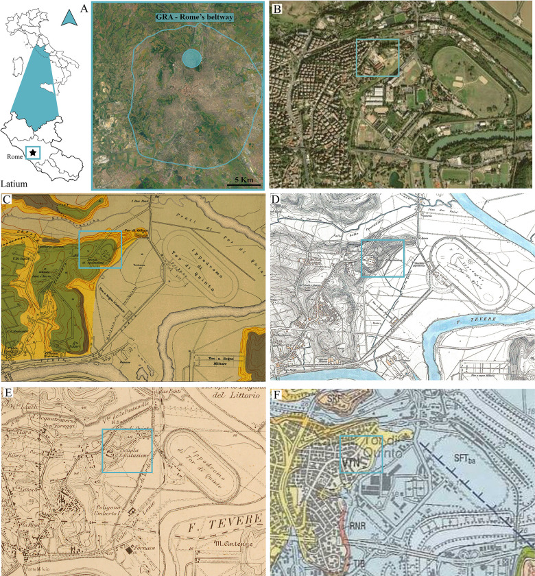
Fig 2.
Location of the studied area of Tor di Quinto (A [modified by 100]-B [taken by USGS National MAP Viewer]. Sketches of the historical geological and topographic maps by [126] (C), [127] (D), [128] (E), and [35] (F). In the blue bounded square it is reported the location of the former military riding school (“Scuola di Equitazione”).

