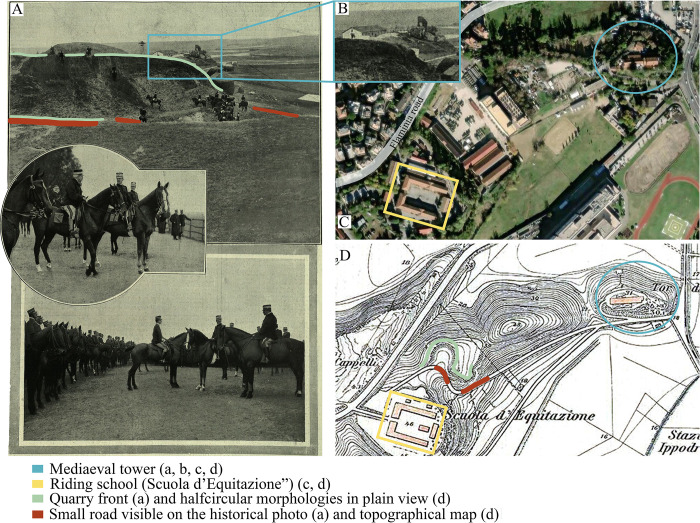
Fig 3.
Historical picture of the Tor di Quinto area from the archive of the Istituto Superiore per la Protezione e la Ricerca Ambientale (ISPRA, A, B) and the same area today (taken by USGS National MAP Viewer, C) and from topographic maps by [127] (D).

