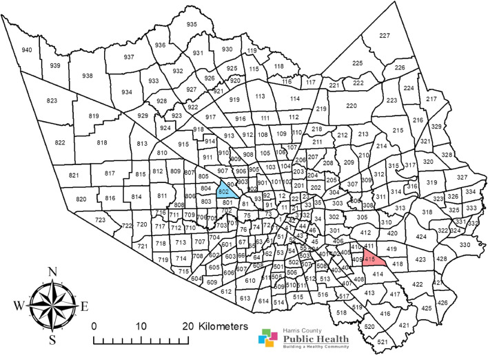
FIGURE 1.
Adult Culex quinquefasciatus were sampled from two operational areas, area 415 and area 802, in Harris County, Texas. Area 415 is highlighted in red while area 802 is highlighted in blue. This map shows the Harris County boundary, presented as a map image layer created by PHES_AGO on 7 June 2017, and updated on 7 May 2020. This map also shows the operational area boundaries, presented as a map image layer crafted by PHES_AGO on 4 November 2016, and updated on 9 May 2020. The map layer for county boundary (Map service: Harris County boundary masked) (https://www.arcgis.com/home/item.html?id=a8aa2ef4067348c79ccea62857a2f623) and the layer for Harris County operational area boundaries (MVCD_Operational_Areas) (https://www.arcgis.com/home/item.html?id=66643535e01b42d3aae5d4647f5e1a6c) were generated with ArcGIS (https://www.arcgis.com/home/webmap/viewer.html; ESRI, CA) by Harris County Public Health and are publicly available. There are no special restrictions or limitations on the terms of use of the layers integrated into this map. This map was completed by assembling these two layers and by coloring the research areas using the ArcMap 10.8 software (ESRI, CA).

