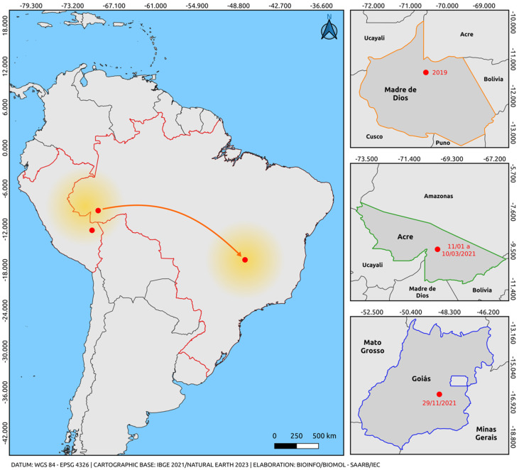
Figure 3.
Map illustrating the possible route of introduction and dispersal of the DENV-2 cosmopolitan genotype. The orange arrow indicates only the departure from the point of origin and arrival through an unmapped route (Madre de Dios, Peru) (Acre/Brazil-Goiás/Brazil), based on the analysis of sequences obtained from reports in the last five years and the sequences from this study. The highlighted arrow is not related to the virus dispersion route; it only indicates the departure from the point of origin (Madre de Dios, Peru, and Acre, Brazil) and the destination (via an unmapped route) of Goiás, Brazil. The colors represent the states and intersections between regions of the countries (Orange: Madre de Dios, Peru; Green: Acre, Brazil; Blue: Goiás, Brazil; Red: border region between Brazil and Peru). The yellow gradient circle indicates the potential spread of the strain to other regions of Brazil and neighboring countries. The map was created using QGIS software v.3.28, available at https://qgis.org/pt_BR/site/ (accessed on 9 June 2023).

