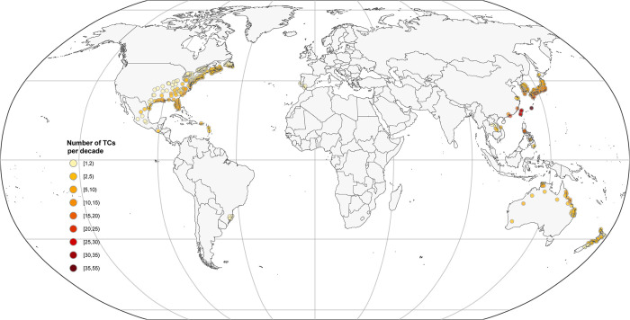
Fig 1. The spatial distribution and number of exposed TCs of the 494 study locations.
. The base layer of the world map was imported from the public domain Natural Earth project (source: https://www.naturalearthdata.com/downloads/; terms of use: www.naturalearthdata.com/about/terms-of-use/). TC, tropical cyclone.

