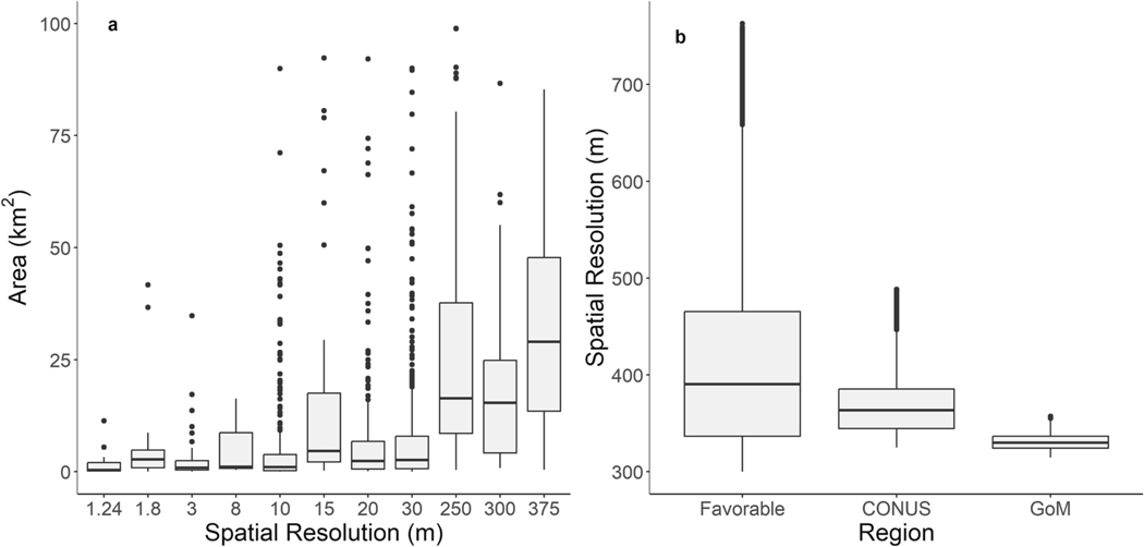
Fig. 6.
(a) Spatial resolution of optical satellites and reported oil spill areas from 1325 NOAA marine pollution surveillance reports between 2011 and 2021. Increase oiled area with coarser resolution satellites was due to the coverage area difference, where coarser resolution satellites covered larger areas than higher resolution satellites. (b) The spatial resolution for the favorable viewing area of 50° N to 50° S and 40° W to 155° W at the geostationary orbit of 98° W, CONUS, and Gulf of Mexico.

