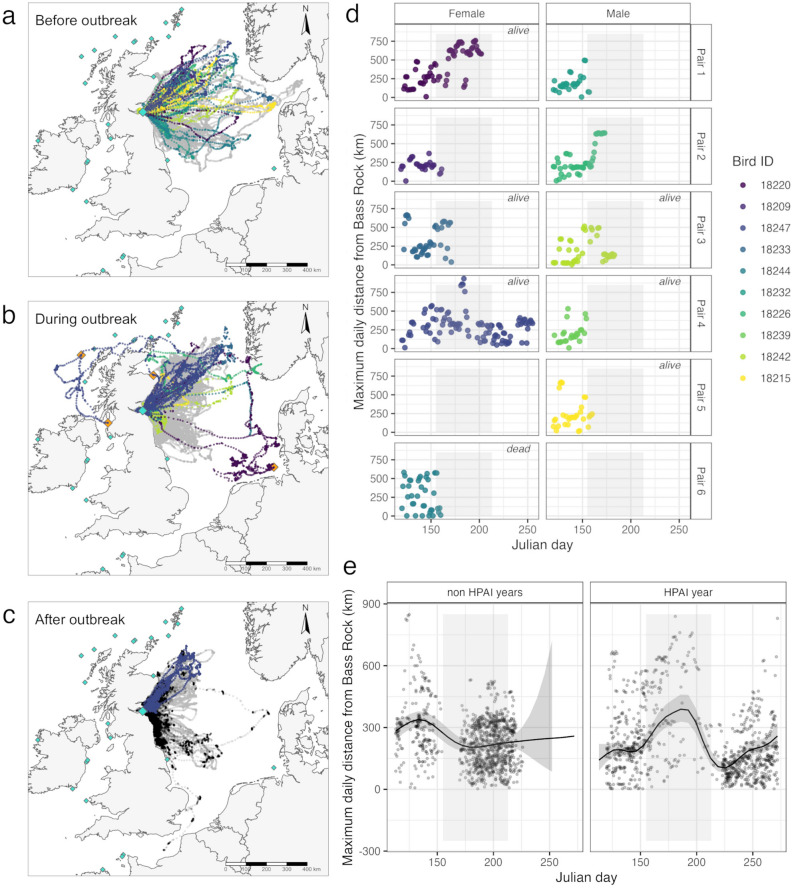
Figure 1.
(a) Movements of breeding adult gannets before the outbreak of HPAIV on the Bass Rock before the 4th of June, (b) during the outbreak up until 31st July and (c) after the outbreak. Gannets GPS-tracked from April 2022 onwards are individually coloured (see legend), positions for gannets tagged in 2015–2019 in grey and from August 2022 in black. The study colony Bass Rock is indicated by a large turquoise diamond, colonies visited by GPS tracked birds are shown as large orange diamonds and unvisited colonies are shown as small turquoise diamonds. The background map was created in R 4.3.2, based on the freely accessible 1:10 m world coastlines shapefile downloaded from https://www.naturalearthdata.com/downloads/10m-physical-vectors/ (d) Maximum daily distances from the Bass Rock colony for gannet pairs tracked during the HPAI outbreak, individual colours correspond with movement data in A, B and C. (e) The relationship between maximum daily distance and Julian day for all other years (left) and the HPAI year (right, gamm prediction, confidence interval and raw data). The light shaded area in (d) and (e) refers to the time period during the HPAIV outbreak corresponding to the map in (b).

