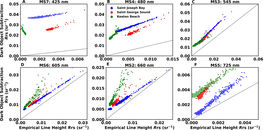
Figure 5.
Comparison between retrieval for ELH and DOS atmospheric correction for WV-2 bands MS2 through MS7. Data for each site are indicated by symbol color. Dotted line represents the 1:1 line of perfect agreement. Data consist of 300 randomly chosen points from each site, 100 from seagrass, 100 from submerged sand, and 100 from deep water.

