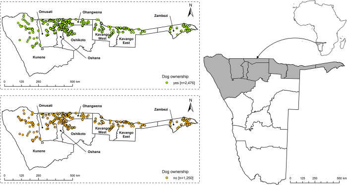
Fig 1.
Map of Africa and Namibia showing the eight regions of the Northern Communal Areas (NCAs, right). In the zoom outs, the location of the surveyed households (HH) in the NCAs from April to June 2021 is shown. HHs without dogs and dog owning households (DOHHs) are highlighted in green and orange, respectively (right). Map content was produced with Esri ArcGIS software using study data and data provided by GADM available online: https://gadm.org/download_country.html.

