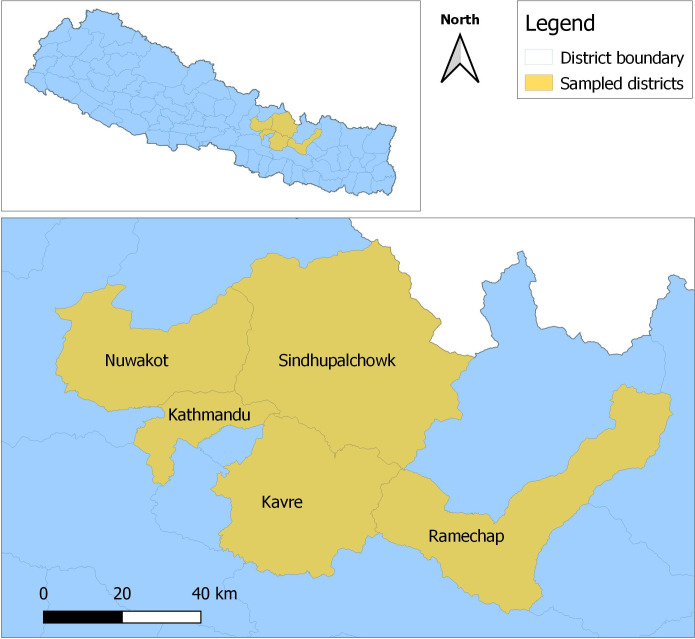
Fig 1. Selected poultry farms in the districts (Kavre, Sindhupalchowk, Ramechhap and Nuwakot) surrounding Kathmandu valley.
The top map shows location of the districts in Nepal and the bottom map shows their location in respect with Kathmandu District (shown just for reference, not a sampling site). The map was generated using QGIS software, Version 3.30.0 [23]. The base map of Nepal administrative shape files was obtained from Open Data Nepal (http://opendatanepal.com).

