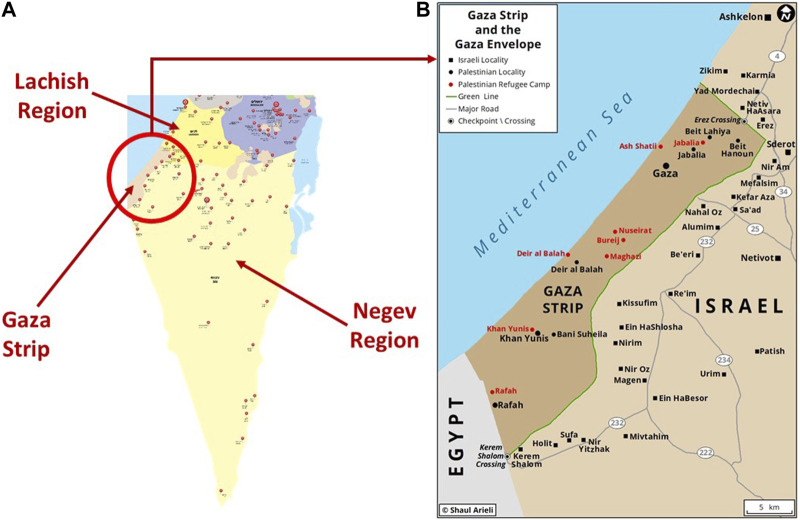
FIGURE 1.
(A) is a map of Southern Israel showing the location of Gaza strip and the two MDA regions bordering it: Negev and Lachish. The red markers represent the location of MDA stations (Israel, 2023); (B) is an enlarged map of the attack region (Source: Gaza strip and envelope, Shaul Arilei, https://www.shaularieli.com/en/maps/among-other-things/, reproduced with permission).

