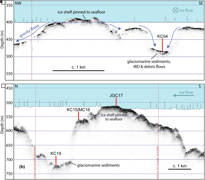
Fig. 5.
Acoustic sub-bottom profiles across seafloor highs H2 (A) and H1 (B), which are former ice-shelf pinning points. The upper image shows the location of core site KC04 within a local basin on the H2 summit. The blue area schematically illustrates past ice shelf pinning near site KC04. Dark blue arrows indicate most likely directions of gravitational sediment transport. The lower image shows the locations of core sites KC15/MC16, JGC17 and KC19 on the SW flank of H1. Depths shown here are approximate as they are derived from a simple conversion of two-way travel time to depth assuming a constant acoustic velocity of 1,500 m/s.

