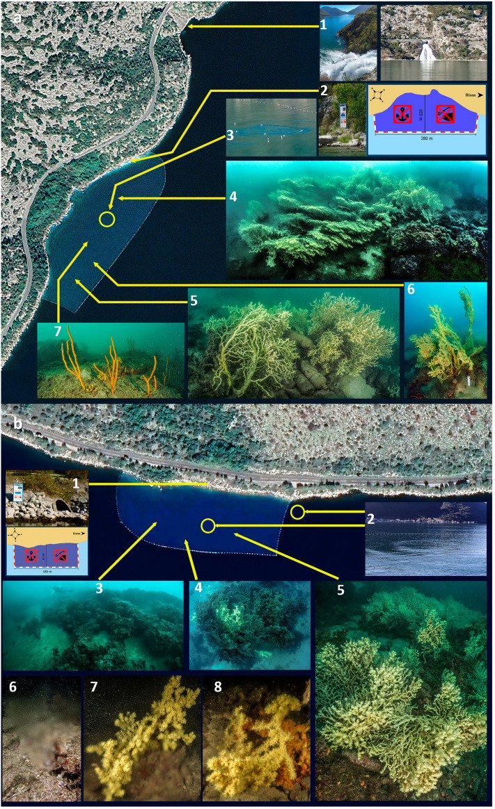
Figure 4.
(a) The Sopot protected area. a1 the freshwaters outflows, 250 m northern of the protected area evidenced by a line of floating buoys; a2 sign on the coast indicating the protected area; a3 outgoing flow of freshwater (vrulja) visible from the surface; a4-5 the main Savalia savaglia patches of the area; a6 the higher recorded colonies in the patch; a7 Axinella polypoides facies, exclusive of this site. The Sopot aerial image is modified by Google Earth—Image
© 2024 Maxar Technologies. (b) The Dražin vrt protected area. b1 position of the sign on the coast indicating the protected area; b2 positions of the vrulja present in the area; b3 Cladocora caespitosa reefs; b4-5 the deeper patches of S. savaglia where signs of necrosis were recorded; b6 image of the freshwater flowing from the detritic bottom; b7-8 S. savaglia colonies directly involved in the vrulja outflow. The aerial image of Drazin vrt is modified by Google Earth—Image © 2024 CNES Airbus.

