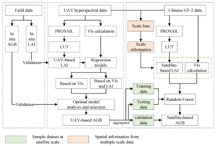
Figure 2.
The flow of estimation of grassland aboveground biomass. Firstly, the field measurements were used for modeling and validation of AGB estimation from UAV data. The comparison between models, including SR, PLSR, BPNN and RF, was carried out with and without the vegetation structure parameter LAI. Then, the scale bias between UAV data and satellite data was extracted and used as prior information to correct the satellite-retrieved indicators. The UAV-based AGB was aggregated as the sample dataset for satellite remote sensing modeling. Finally, the satellite-based AGB was mapped and validated.

