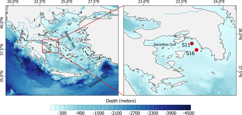
Figure 5.
Panel (a): Sea-floor elevation of the EMS. Numbers represent the main rivers with 1: Aliakmonas, 2: Acheloos, 3: Pinios, 4: Evros, 5: Nestos, 6: Strimonas, 7: Alfeios, 8: Arachtos, 9: Spercheios, 10: Loudias, Axios, Gallikos (left to right). Panel (b): The location of the two sampling stations S11 and S16 (23.64∘ E, 37.87∘ N and 23.70∘ E, 37.79∘ N, respectively) in inner Saronikos Gulf. (Plots created using QGIS 3.16 software, https://www.qgis.org/en/site/index.html).

