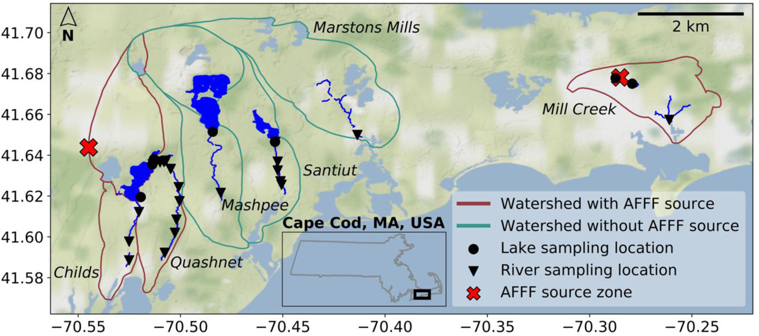
Fig 1. Field sampling locations on western Cape Cod, Massachusetts, USA.

Samples were collected between August 2017 and July 2019. Groundwater-flow models of the sandy glacial Cape Cod aquifer were used to delineate watershed boundaries shown in crimson and green.25,26 Three watersheds outlined in crimson (Childs, Quashnet, Mill Creek) contain a known source zone (marked by red crosses) for PFAS due to use of aqueous film forming foams (AFFF). Three watersheds outlined in green (Marstons Mills, Mashpee, Santuit) represent background locations with no known AFFF source zone.
