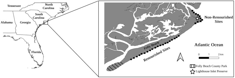
Fig 1. Field site map.
Map of Folly Beach, SC, USA, where field sites were located. Field sites with circles indicate renourished areas, while those with squares indicate non-renourished areas. The Inset map shows South Carolina in reference to the southeastern U.S. coastline. This map was created using ArcGIS software from ESRI. [38] The basemap is supported by ESRI and licensed under the ESRI Master License Agreement. Copyright ESRI 2024. All rights reserved. Available from: https://services.arcgisonline.com/ArcGIS/rest/services/Canvas/World_Light_Gray_Base/MapServer. Edited after creation with BioRender.com.

