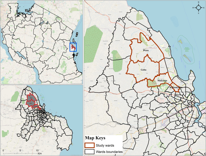
Fig 1. Study area and experimental sites in Dar es Salaam.
The green polygons represent five wards within the Kinondoni Municipality within which eight sampling blocks were located. This map was produced with ArcGIS ©2023 Esri, licensed to the Ifakara Health Institute, using a base map obtained from OpenStreetMap © OpenStreetMap contributors, under the Open Database License.

