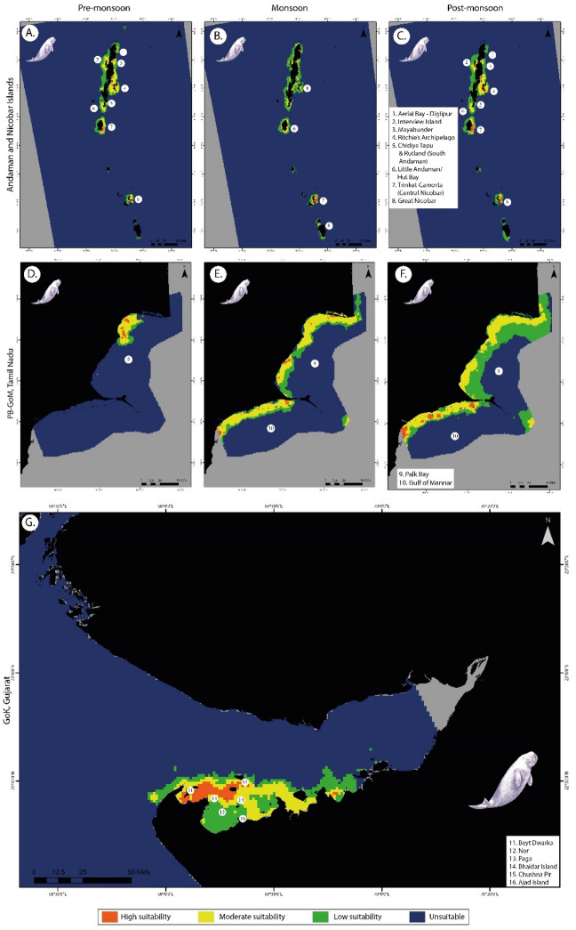
Figure 2.
Habitat suitability predictions for dugongs in (A) pre-monsoon, (B) monsoon, (C) post-monsoon at Andaman & Nicobar Islands; (D) pre-monsoon, (E) monsoon, (F) post-monsoon at Palk Bay and Gulf of Mannar, Tamil Nadu; and (G) Gulf of Kutch region, Gujarat. Here, each class corresponds to values 0–0.25 (unsuitable), 0.25–0.5 (low suitability), 0.5–0.75 (moderately suitable) and 0.75–1 (highly suitable) regions, respectively. The suitability layers were generated using MaxEnt v.3.4.4 software (https://biodiversityinformatics.amnh.org/open_source/maxent), and the final maps were generated using ArcGIS Pro v.3.2.1 software (https://www.esri.com/en-us/arcgis/products/arcgis-pro/overview).

