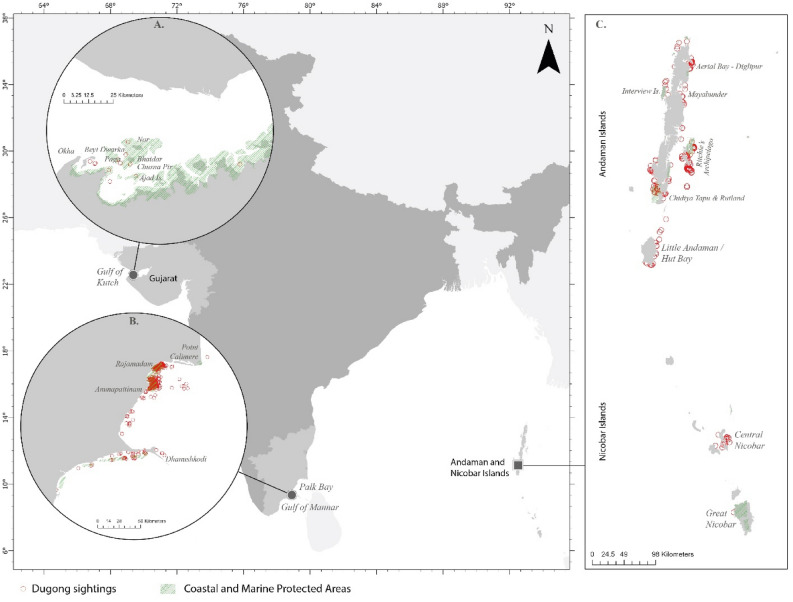
Figure 7.
Study sites along the Indian coastline (A) Gulf of Kutch (GoK), Gujarat on the northwest coast in the Arabian Sea; (B) Andaman & Nicobar Islands (ANI)—offshore islands located in the Bay of Bengal to the south–east of peninsular India (C) Palk Bay and Gulf of Mannar (PB-GoM), Tamil Nadu to the south–east coast in the Bay of Bengal. The red circles represent dugong sighting locations between 2008 and 2021. The output maps were generated using ArcGIS Pro 3.2.1 software (https://www.esri.com/en-us/arcgis/products/arcgis-pro/overview).

