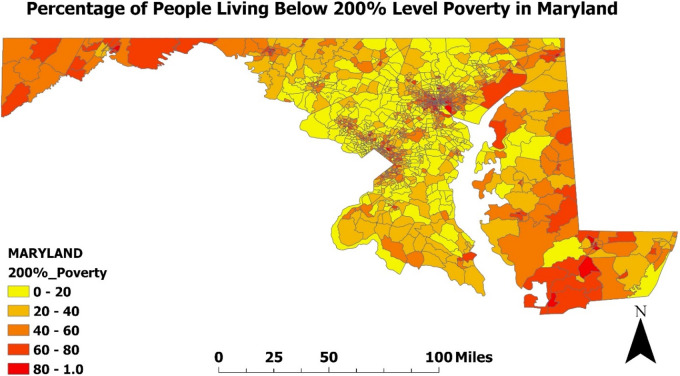
Figure 3.
Percentage of people living below poverty level in Maryland (2020): Map of the percentage of people living below the 200% poverty level in Maryland was developed using ArcGIS software and data extracted from the CDC environmental justice Index. The map is displayed at the census tract level, which are subdivisions of counties used by the Census to gather statistical data. Darker colors on the map represent a higher percentage of poverty.

