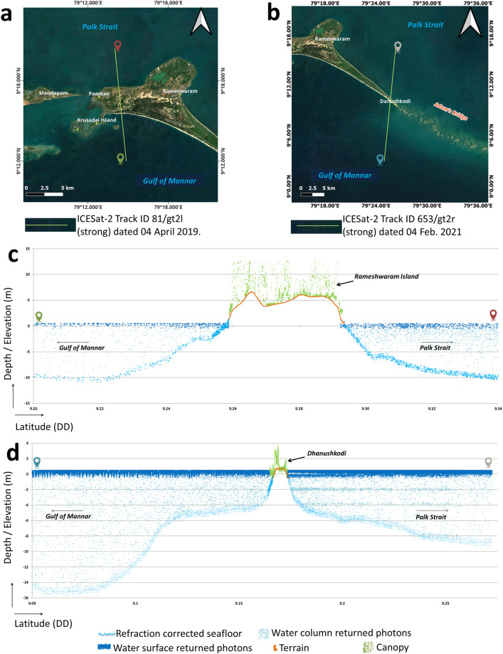
Fig. 6.
Illustration of ICESat-2 photons acquired over the extent of land and seawater surrounding Adam’s Bridge. (a) ICESat-2 beam acquired over Rameshwaram Island and overlaid on the satellite data. (b) ICESat-2 beam acquired over Dhanushkodi and overlaid on the satellite data. (c) 2-dimensional profile showing the seafloor and the land/canopy for the beam shown in (a). (d) 2-dimensional profile showing the seafloor and the exposed land part at the Dhanushkodi with respect to the beam shown in (b).

