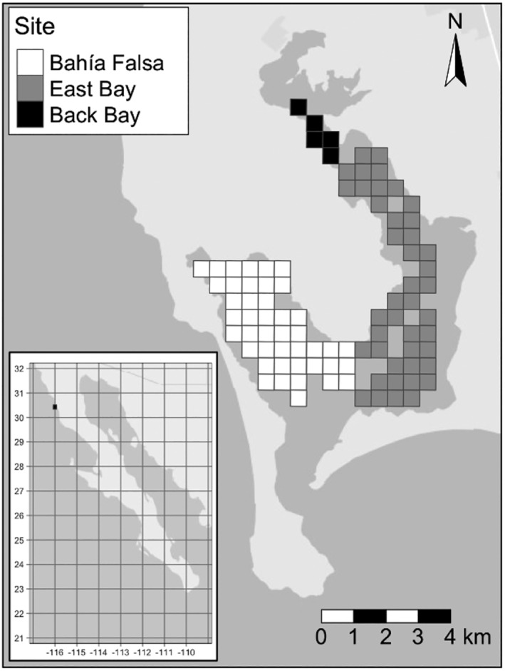
FIGURE 2.

Map of Bahía San Quintín and its location within Mexico, showing the distribution of eelgrass patches included in the model. The symbol shading identifies patches within subsites of the bay. Latitude and longitude are shown on the insert map.
