Figure 3.

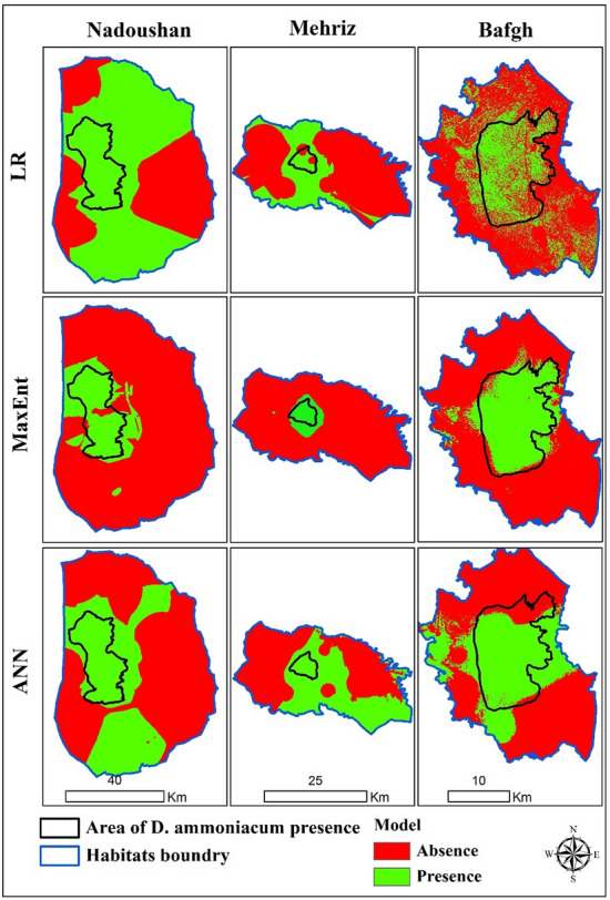
Modeled maps of D. ammoniacum species using three methods in three habitats (The processing and creation of spatial change maps resulting from species distribution modeling were conducted by the researchers using ArcGIS version 10.139).

Modeled maps of D. ammoniacum species using three methods in three habitats (The processing and creation of spatial change maps resulting from species distribution modeling were conducted by the researchers using ArcGIS version 10.139).