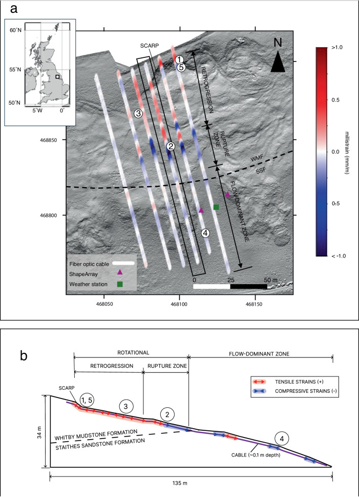
Fig. 1. Hollin Hill landslide observatory and the fiber optic cable.
a Inset figure shows the location of Hollin Hill. Inset figure was created using PyGMT71, a Python wrapper for Generic Mapping Tools72. Base image from bare-earth lidar from a November 2020 terrestrial lidar scan. Grid coordinates per the British Grid OSGB36 datum. The in situ Whitby Mudstone Formation (WMF) and Staithes Sandstone Formation (SSF) geological boundaries are per37. Unprocessed cable sections perpendicular to the direction of slope movement are not shown. DAS strain data corresponding to 2021-01-15T11:00. Soil moisture content sensor and precipitation gauge are located at the weather station. Numbered sequences show the approximate location of DAS channels, described in the results. b Conceptual model illustrating the main landslide zones and approximate strain changes for the same time as in (a). Strain vector lengths are qualitative and do not represent actual strain magnitudes. Numbered sequences show the approximate location of DAS channels, described in the results.

